MARTINSBURG, W.Va. (September 17, 2026) — FEMA is proposing updates to the Flood Insurance Rate Map (FIRM) for Berkeley County, West Virginia. Community partners are invited to participate in a 90-day appeal and comment period.

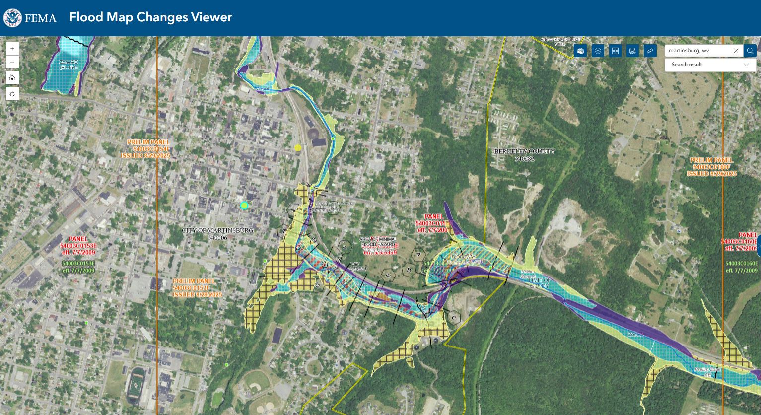
Screenshot of FEMA map
The updated maps were produced in coordination with local, state and FEMA officials. Significant community review of the maps has already taken place, but before the maps become final, community partners can identify any corrections or questions about the information provided and submit appeals or comments.
The 90-day appeal period began on September 16, 2026. Residents, business owners and other community partners are encouraged to review the updated maps to learn about local flood risks and potential future flood insurance requirements. They may submit an appeal if they perceive that modeling or data used to create the map is technically or scientifically incorrect.
- An appeal must include technical information, such as hydraulic or hydrologic data, to support the claim.
- Appeals cannot be based on the effects of proposed projects or projects started after the study is in progress.
- If property owners see incorrect information that does not change the flood hazard information—such as a missing or misspelled road name in the Special Flood Hazard Area or an incorrect corporate boundary—they can submit a written comment.
The next step in the mapping process is the resolution of all comments and appeals. Once they are resolved, FEMA will notify communities of the effective date of the final maps.
Submit appeals and comments by contacting your local floodplain administrator:
- For Berkeley County (Unincorporated Areas), please contact Randy Lilly by email at rlilly@berkeleywv.org or by phone at 304-263-1345.
- For the City of Martinsburg, please contact Kaityln Snyder by email at ksnyder@cityofmartinsburg.org or by phone at 304-264-2131.
The new preliminary maps for Berkeley County may be viewed online at the FEMA Flood Map Changes Viewer.
For more information about the flood maps, contact a FEMA Map Specialist by telephone; toll free, at 1-877-FEMA-MAP (1-877-336-2627) or by email at FEMA-FMIX@fema.dhs.gov.
Most homeowner’s insurance policies do not cover flooding. There are cost-saving options available for those newly mapped into a high-risk flood zone. Learn more about your flood insurance options by talking with your insurance agent and visiting https://www.floodsmart.gov.
Berkeley County Flood Mapping Milestones
- April 4, 2025 — Flood Risk Review Meeting to review draft flood hazard data.
- August 29, 2025— Preliminary Flood Insurance Rate Map released.
- October 2, 2025 — Community Coordination and Outreach Meeting to review Preliminary Flood Insurance Rate Map and discuss updates to local floodplain management ordinance and flood insurance.
- September 16, 2026 –Appeal Period starts.
- September 2027* — New Flood Insurance Rate Map becomes effective and flood insurance requirements take effect. (*Timeline subject to change pending completion of the appeal review process.)If you have any questions, please contact FEMA Region 3 Office of External Affairs at (215) 931-5597 or at femar3newsdesk@fema.dhs.gov.